Aotea Great Barrier Island
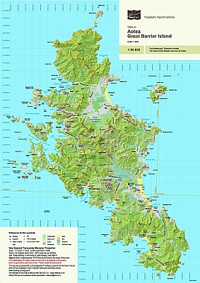
This map portrays the walking track network on Great Barrier Island (Aotea) on a fully detailed topographic background. The limited roading and few settlements are also shown. The combination of contours and relief shading, gives a realistic landform.
| Scale | 1:90 000 |
|---|---|
| Edition | 1 |
| Year | 2008 |
| Price | $9.00 |
Technical Details
20m contours. 1km grid. 15 minute geographic graticule.
New Zealand Transverse Mercator projection
Finely printed on 113gsm Sumo K Matt paper.