Auckland Walks: North
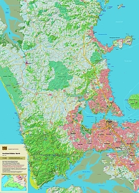
The map gives emphasis to the walking tracks and routes West and North of Auckland, including the Waitakere ranges, and the access roads to them. It is very easy to read with a clear road network and full topography. The combination of contours and relief shading, gives a realistic landform.
| Scale | 1:75 000 |
|---|---|
| Edition | 1 |
| Year | 2007 |
| Price | $11.00 |
Technical Details
20m contours. 1km grid. 15 minute geographic graticule.
New Zealand Transverse Mercator projection
Finely printed on robust, waterproof, synthetic paper.
Known Errors
Woodhill Forest: Check track availablity at the Information Portal.