Wangapeka Track
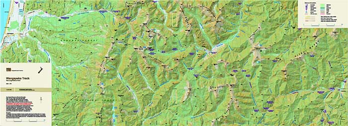
The Wangapeka Track crosses an isolated and complex mountain system between the Waimea Basin near Tapawera south of Nelson, over two 1000m passes to the West Coast near Little Wanganui, south of Karamea. The tramping track is 59km long passing through beautiful beech forests and takes four to six days. The map shows the full length of the track and the road access at each end. The combination of contours and relief shading gives a realistic landform.
| Scale | 1:55 000 |
|---|---|
| Edition | 1 |
| Year | Publication deferred |
| Price | $11.00 |
Technical Details
Small format 420x297mm. (A3 two sided)
20m contours. 1km grid. 10 minute geographic graticule.
New Zealand Transverse Mercator projection
Printed on 113gsm Sumo K Matt paper