Tongariro Alpine Crossing
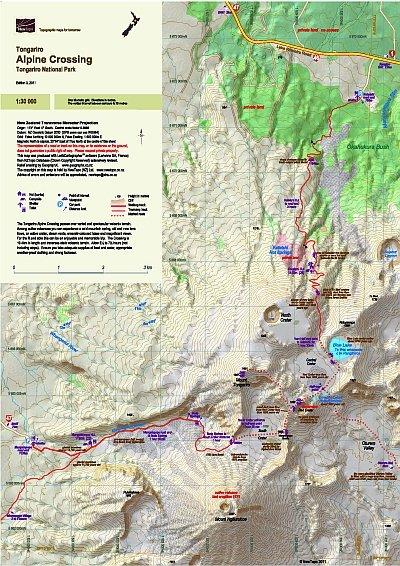
About 65,000 people walk the Tongariro Alpine Crossing each year. This map shows the route and its unique geographic environment at a scale where all features can be identified, increasing both the enjoyment and safety of walkers. The combination of the large scale, twenty-metre contours and relief shading, gives a realistic landform. Geological notes on the volcanoes add an educational aspect to the journey.
| Scale | 1:30 000 |
|---|---|
| Edition | 4 |
| Year | 2012 |
| Price | $9.00 |
Technical Details
Small format 297x420mm (A3)
20m contours. 1km grid. 10 minute geographic graticule.
New Zealand Transverse Mercator projection
Printed on 113gsm Sumo K Matt paper.