Auckland Walks: South
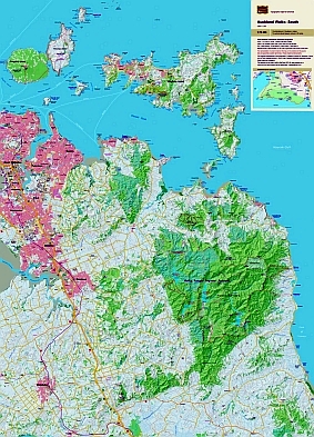
The map gives emphasis to the walking tracks and routes East and South of Auckland, including the Hunua ranges, and the access roads to them. It is very easy to read with a clear road network and full topography. The combination of contours and relief shading, gives a realistic landform.
| Scale | 1:75 000 |
|---|---|
| Edition | 1 |
| Year | 2007 |
| Price | $11.00 |
Technical Details
Large format 600x840mm.
20m contours. 1Km grid. 15 minute geographic graticule.
New Zealand Transverse Mercator projection
Finely printed on robust, waterproof, synthetic paper.
Known Errors
Part of the Kohukohu Track is incorrectly labelled Adams Lookout Track. The track shown from this track joining the East Coast Road to the NE does not exist.
South of the Whakatiwhai Track, the ridge track parallel to Paparoa Stream does not exist.