Routeburn, Greenstone
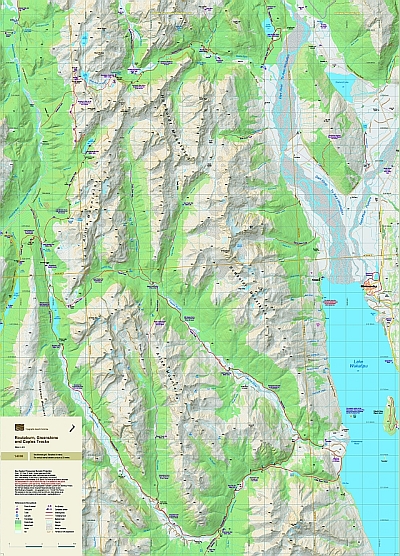
These popular tracks are in a dramatic landscape. The map portrays the full length of both tracks, as well as the Caples Track which lies in between them, on a fully-detailed topographic background, which does justice to the environment. The few road access points are shown. The combination of contours and relief shading gives a realistic landform. Overlaps the Five Passes Wilderness map to the north and the Rees-Dart map to the north east.
| Scale | 1:40 000 |
|---|---|
| Edition | 3 |
| Year | 2013 |
| Price | $20.00 |
Technical Details
Large format 600x840mm.
20m contours. 1km grid. 10 minute geographic graticule.
New Zealand Transverse Mercator projection
Printed on 94gsm high wet strength paper.