Tararua Tramps
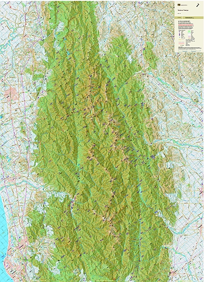
The Tararua Ranges present both challenges and enjoyment to Wellingtonians. The map shows the walking tracks and routes in the Ranges, and the access roads to them. The combination of contours and relief shading, gives a realistic landform. The map overlaps the Wellington Outdoors map to the South.
| Scale | 1:55 000 |
|---|---|
| Edition | 2 |
| Year | May 2012 |
| Price | $25.00 |
Technical Details
Large format 840x630mm. Two sided. Skew.
20m contours. 1Km grid. 10 minute geographic graticule.
New Zealand Transverse Mercator projection
Printed on 94gsm high wet strength paper.
Known Errors
The following 'marked routes' are:
not marked:
- Mitre Flats to Mid King Biv
- the eastern spur off Baldy
- Waiohine George to Mt Reeves Track
- Carkeek Hut to Nichols
- Jumbo-The Kings-Girdlestone-Mitre-Pukematawai
cut tracks:
- Cow saddle to Cattle Ridge
- Cow Ck Hut to Arete Forks via Table Ridge
- Omega Track(Tauherenikau)